Home
Soluzioni

...

Tutela Ambientale

Ecological Environment

Panoramica

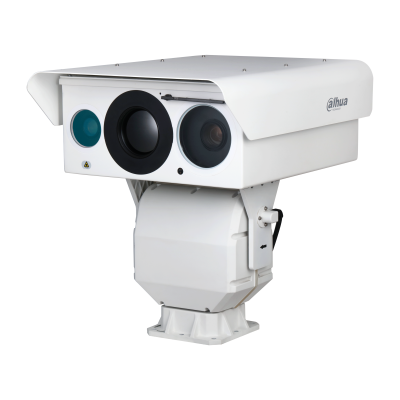
Ecological Environment solutions focus on key natural areas such as forests, rivers, reservoirs, and coastal waters, using thermal cameras, radar, drones and IoT sensors to build a unified monitoring network. By combining water level and floating-object detection with early smoke-and-fire warning, the platform provides real-time visibility of wildfire risks, flooding and pollution events, enabling fast location of incidents, coordinated emergency response, and long-term ecological protection for both ecosystems and surrounding communities.

1

Forest

2

Water Area

1

Forest

2

Water Area

Forest

Sfide

Forests and national parks often stretch across steep slopes and deep valleys, where human patrols are slow and traditional cameras struggle with distance, night-time darkness, and haze. Early fire points are tiny and easily masked by vegetation, while clouds, fog, and sunlight can cause false alarms. Without reliable long-range detection from high positions, it is difficult to spot small ignition points or thin smoke in time, leading to delayed response and greater risk of large wildfires.

Forests and national parks often stretch across steep slopes and deep valleys, where human patrols are slow and traditional cameras struggle with distance, night-time darkness, and haze. Early fire points are tiny and easily masked by vegetation, while clouds, fog, and sunlight can cause false alarms. Without reliable long-range detection from high positions, it is difficult to spot small ignition points or thin smoke in time, leading to delayed response and greater risk of large wildfires.

Water Area

Sfide

Conventional water level gauges are point-based and easily affected by damage, silt, or waves, while ordinary cameras can only provide visual reference without accurate data. Many sites lack linkage between water warnings and video verification, so abnormal rises, backflow, or blocked channels may not be discovered until flooding or overflow occurs. Manual patrols are time-consuming, especially in long river sections and remote areas, leading to delayed awareness of sudden storms or upstream discharges.

Conventional water level gauges are point-based and easily affected by damage, silt, or waves, while ordinary cameras can only provide visual reference without accurate data. Many sites lack linkage between water warnings and video verification, so abnormal rises, backflow, or blocked channels may not be discovered until flooding or overflow occurs. Manual patrols are time-consuming, especially in long river sections and remote areas, leading to delayed awareness of sudden storms or upstream discharges.